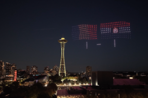
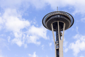
The Space Needle is clearly the most iconic building in Seattle’s skyline, and the 56-year-old structure is currently undergoing a $100-million renovation of its top house. But thanks to a panoramic camera mounted on the landmark back in 2015, changes going on around the Needle and across Seattle are also evident.
Images from that camera were used to make a time-lapse video that has gone viral this week, as it shows — in just 4 minutes — the rapid growth that has taken place in Seattle in just three years.
Ricardo Martin Brualla, a Google engineer who moved to the city seven years ago, created the video using thousands of photographs, and on YouTube he’s attracted nearly 100,000 views in 24 hours.
PREVIOUSLY: The rapid rise of new Seattle: Time-lapse video shot over 3 years captures city’s massive growth
For those who were previously unfamiliar with the PanoCam, as the Space Needle calls it, the digital experience went live back on Jan. 1, 2015. A news release from the summer of that year provides more details on the objective behind turning a camera on Seattle and directing eyeballs away from the Needle itself and toward what visitors to the 605-foot-tall structure’s observation deck get to see.
Images are taken every 10 minutes beginning one hour before sunrise and ending one hour after sunset, the release said, thanks to what is called the “world’s most advanced webcam” with imaging technology from Roundshot Livecam of Lustdorf, Switzerland.
The camera is mounted on the Needle’s spire and takes individual images of up to 66 million pixels. Those images are automatically stitched together, creating a complete panoramic view. The Space Needle said at the time that it was the only tower or office building in the U.S. using such a device. Note to the city which eventually becomes home to Amazon’s HQ2: find a spot for your camera now. You’ll want to remember what things used to look like.
“The Space Needle was built to be the perfect perch to see the beauty of the Pacific Northwest,” said Karen Olson, vice president of marketing for the Needle, back in 2015. “Now with the PanoCam, we can capture and share the best views of the city — from glowing sunrises, to peak-a-view foggy days to some of the most beautiful sunsets on the west coast.”
Indeed, some of those “best views” are certainly breathtaking — and they’re earmarked for easy viewing on the PanoCam site. In the righthand menu, users can choose “all views” and see every date from today back to Jan. 1, 2015. Or they can choose “best views” and browse through 32 panoramas that have been selected over time to showcase particularly interesting clouds, fog, sunrises or sunsets. There’s even a shot that catches the arc of a Blue Angels jet flying over Lake Washington.


Here’s to hoping the Space Needle digital team catches up, though, because the last “best view” posted was back on Aug. 16, 2016. Certainly there’s been some show-off weather or light since then.
It’s clear that the story of Brualla’s video has attracted so much attention because of the fact that it showcases why Seattle is the fastest growing city in the United States. Those who have lived in the region for a while and experienced that growth — in traffic, staring at cranes, watching old buildings and houses come down, etc. — are mesmerized by a quick video that sums up what they’ve been witnessing in normal time.
The Amazon boom that is reshaping South Lake Union and the Denny Triangle are of particular interest. Low-slung buildings fall and towers rise in the blink of an eye to create the tech giant’s urban campus. Even today, it’s easy to launch the PanoCam and pause on Amazon’s Day 1 and Doppler Towers and see the changing pit where — cranes in place — a third tower will grow in the coming months.
Further south, the gleaming and angular F5 Tower is visible next to the tall, black Columbia Tower as further proof of downtown Seattle’s rise as a tech hub.

On Twitter, folks reacting to the video and GeekWire’s story have expressed amazement at the ability to witness all the changes. Some see it all as a clear sign of Seattle’s demise, on various levels — all that growth means unaffordable housing, horrible commutes, a spike in homelessness, and more doom-and-gloom scenarios for the city to grapple with.
Others are proud to call the city home and see it as a beacon of what’s possible with a thriving economy and attractive setting. It doesn’t hurt that the PanoCam shows more than just “crane city” and captures the stunning natural beauty that stretches from the Cascade Mountains down to Mount Rainier, across Elliott Bay and further on to the Olympics.
The Space Needle says the camera will capture images for years to come, with an eye toward the city’s evolving skyline. Let’s hope all that growth and change doesn’t eventually block the view.