Wildfire is spreading aggressively through Alberta, Canada, damaging hundreds of thousands of hectares along its path.
Emergency management officials in Alberta have enlisted EagleView Technology Corporation, a Bothell, Wash.-based aerial imagery company, to help survey the damage. Last week EagleView flew its planes over several of the most populated regions in Alberta, capturing images like those featured above.
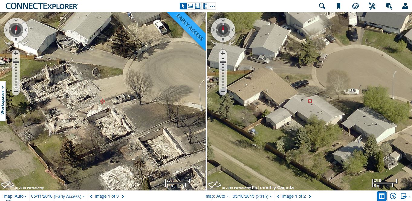
The before-and-after example above, captured on Wednesday, May 11, is part of a 92-square kilometer area in Alberta that EagleView’s planes surveyed.
EagleView used technology from Pictometry, the aerial image company that it merged with in 2013, to create the high-resolution photos. It has a fleet of 73 planes capable of taking oblique images (at an angle) and ortho images (from above). EagleView uses patented technology to process the images for organizations like the Alberta Emergency Management Agency.
“We were able to get our planes to the area as soon as it was determined to be safe to fly; the imagery will be invaluable for helping with damage assessment and recovery efforts,” said Robert Locke, EagleView Government Solutions president, in a press release.


